

13 min read
In this article
- Affection plan Dubai and GIS services for plot owners in short
- What the Dubai Municipality GIS Centre does
- Affection plan Dubai: what the official site plan is
- How to request or renew an affection plan in Dubai
- Dubai Municipality: unified site plan and the Kharetati app
- Other authorities for some plots
- Dubai Land Department: property maps
- Plot information: the digital portal and certificates
- Makani number: the address of a building entrance
- Zoning and land use: where the rules come from
- Levels and survey services that sit next to the site plan
- Using the site plan before designing a villa annex or building
- A simple order of work for plot owners
- Related services
- Frequently asked questions
- What does affection plan mean in Dubai?
- Is the affection plan the same as the site plan?
- How do I get an affection plan in Dubai?
- What is a Makani number?
- What is the difference between a site plan and a property map?
- Can I see my plot's permits online?
- What does the site plan control for a villa annex?
- How much does a site plan cost?
- Need help with your plot?
- Official sources
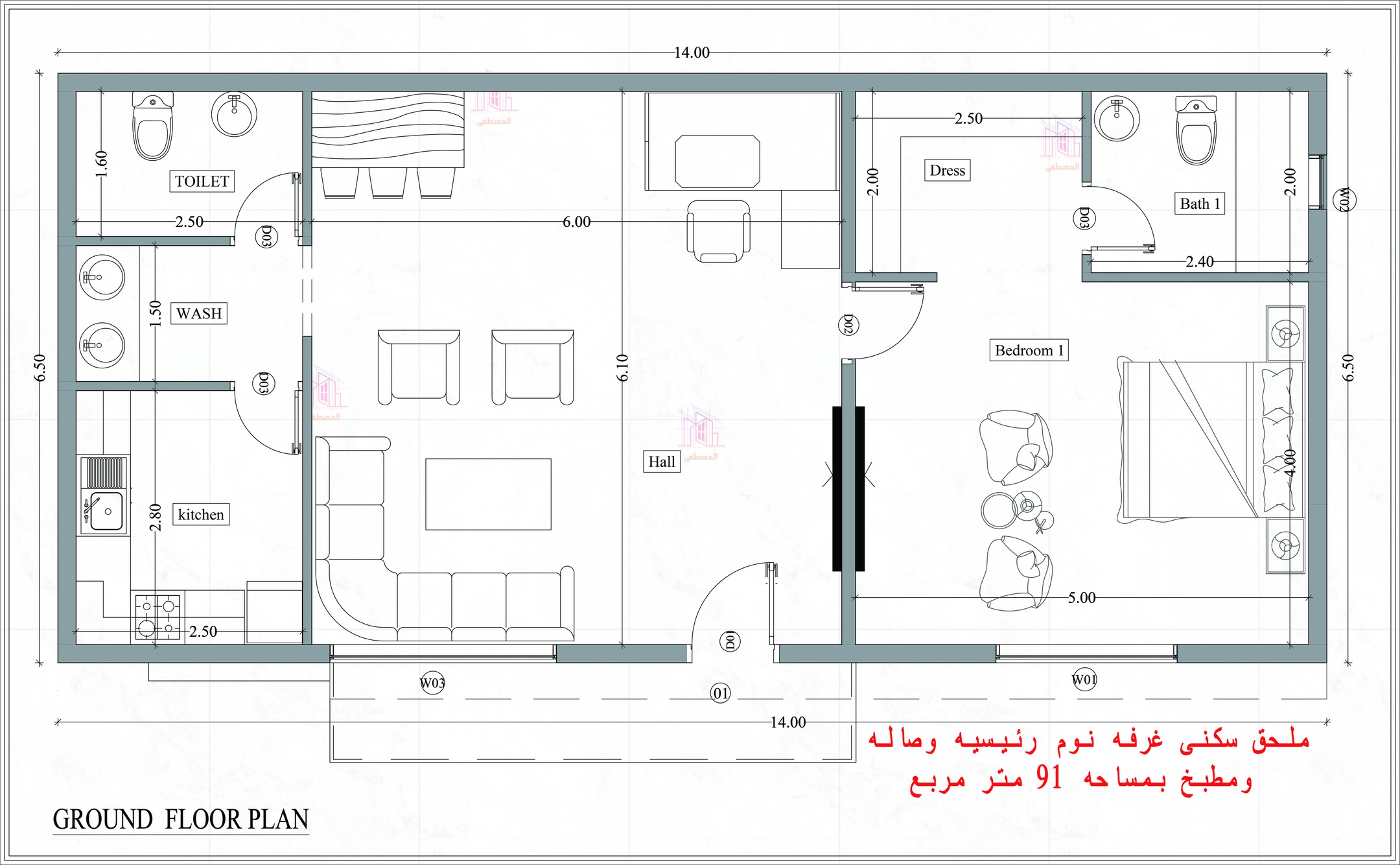
Before a villa annex, a majlis or a new building is drawn, the plot has to be understood: its boundaries, its permitted use, its setbacks and floors. In Dubai that information sits in Dubai Municipality's GIS (geographic information systems) services. This guide explains the affection plan in Dubai (the official site plan), the Makani number, plot information and the GIS maps, as the official pages describe them, and how a plot owner uses them before design starts.
Affection plan Dubai and GIS services for plot owners in short
- The affection plan is the plot's official site plan. The Dubai Building Code defines it as the plan issued by the responsible authority showing the plot limits, dimensions, area, building setbacks, surrounding areas and land uses.
- Dubai Municipality lists a service to issue unified site plans. It describes a detailed plan with boundaries, land tenure, landlord name, zoning, land use, floors, setbacks, parking, location and dimensions.
- The Makani number identifies building entrances. It is a navigation address, not a planning document, so it does not replace the plot's site plan.
- Ownership and permit records can be viewed in Dubai Municipality's digital portal, and property maps for registered properties are issued by the Dubai Land Department.
- The site plan, not a general rule of thumb, sets the limits your engineer designs to. Official fees are shown when you apply, so this guide quotes none.
What the Dubai Municipality GIS Centre does
The GIS Centre was established in 2001 to unify and integrate geographic information in the Emirate of Dubai. Its four sections cover geospatial information (managing, analysing, updating and providing maps), geospatial systems, infrastructure and geospatial intelligence, and geospatial services, which receives requests from beneficiaries. Dubai Municipality's GIS page says the Centre provides and updates maps, plans and geographic information for the emirate and makes the data available to decision-makers, the private sector and individuals according to their needs and clearance.
Several GIS projects are listed on the official page. Dubai Here is a web and mobile system with 2D and 3D maps of assets, buildings and infrastructure, described for planners and city managers. Other projects cover the new electronic building permit system with GIS integration, Makani addressing for indoor units, and data collection for the base map by aerial imagery, drones and a laser-scanning vehicle. For a plot owner, the practical outputs are the site plan, the plot and permit records, and the Makani address.
Affection plan Dubai: what the official site plan is
People use several names for the same plot document: affection plan, site plan, plot plan, or in Arabic the الخارطة الموقعية. Dubai Municipality's service list calls it the unified site plan. The Dubai Building Code gives the definition below, and adds that it is also called the site plan.
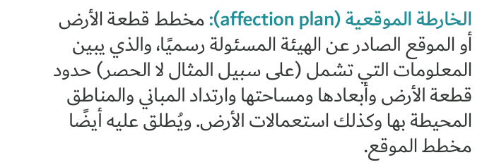
The Code uses the site plan in other places too. The authorised use of a plot is the occupancy allowed under Dubai's land classification, as shown in the official site plan or the development requirements, and parking ratios stated in the site plan or the development control regulations take priority over the Code's own table (section B.7.2.6.1).
How to request or renew an affection plan in Dubai
The route depends on which authority covers the plot and on what you need. In all cases your engineering office will normally ask for the document first, so the owner's task is to know where it comes from.
Dubai Municipality: unified site plan and the Kharetati app
Dubai Municipality's services page lists "Request to Issue Unified Site Plans". GeoDubai describes the Kharetati app as the smart application for issuing and renewing site plans of land parcels. Landholders in all categories (individuals, companies and government institutions) can apply and receive an electronically approved site plan. GeoDubai says the plan arrives in minutes, payment is electronic, required attachments fell from 14 to 3, and the app also lets users look up planning legislation, approved commercial activities and building violations for a plot. The GIS projects page presents this as the "5-Minute Affection Plan" initiative of the GIS Centre and the Survey Department, linked to Emirates ID, residency and trade-licence data. Services are reached through Dubai Municipality's digital services sign-in (the 2023 portal announcement names UAE Pass), and the official service page shows the current steps and fees.
Other authorities for some plots
Not every plot is under Dubai Municipality's planning. Dubai Development Authority describes its own site plan as a legal document issued in the plot owner's or lessee's name, used for construction approvals or for registering the plot with the Land Department, requested through its zoning eServices portal by plot owners, master developers or their representatives. In 2021 Dubai Municipality and the Dubai Land Department announced a unified comprehensive land map project, with the Development Authority, Dubai Silicon Oasis and Dubai South taking part, to hold owner, planning, topographic and infrastructure data in one central geographic database with unified land numbering. So confirm the authority for your plot first.
Dubai Land Department: property maps
The Dubai Land Department issues property maps for registered properties: land, villa, unit and building maps. The steps on its page are submit, review, generate and send by email, through its website, the Dubai REST app or a trustee centre, with a letter from the owner if the owner does not apply in person. A property map usually shows what is registered, while the site plan shows what planning allows to be built. The Land Department's page also offers a land map unified with Dubai Municipality. Designers usually need the site plan.
Plot information: the digital portal and certificates
In August 2023 Dubai Municipality launched an online portal where owners can see their land and property data. After registering with UAE Pass, an owner selects a plot and can view the area name, type of ownership and issue date of the site map, with options to download the schemes. The portal also shows building permit details (licence date, type and number) and completion certificate details, all downloadable.
The services list adds a "To Whom it May Concern" certificate describing plot or building status, issued within one working day according to the page, for uses such as loans and grants. The GeoSpatial Viewer subscription and the request for geospatial maps and data are also listed, the latter for digital maps and data within five working days according to the listing.
Makani number: the address of a building entrance
GeoDubai describes Makani as an intelligent geographic address system that complements the official address system. It relies only on numbers to identify entrances to buildings, entities, farms and free zones, so people of any age and nationality can use it. Dubai Police, Civil Defence, Ambulance, the RTA, Dubai Courts and DEWA are among the entities that GeoDubai says apply Makani in their work. The Makani app searches by building address and navigates with the user's preferred navigation app.
Two practical points follow. First, Makani identifies entrances, and the plot number on the site plan remains the planning identifier. Second, Dubai Municipality's mobile services (call 800 900) include a request for a Makani plate (installing a new plate or replacing one) and a request for a Makani number (issuing a new Makani number for the plot). The GIS page also describes extending the addressing to individual indoor units, with a short code for the building, floor and unit.
Zoning and land use: where the rules come from
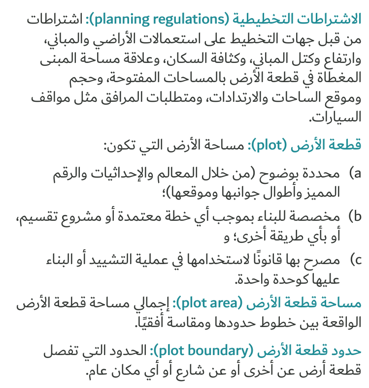
A plot's land use follows Dubai's land-use classification. Local Order 2 of 1999 regulates the classification and codification of land uses in the emirate, and Administrative Decision 260 of 2019 adopted the public services planning standards guide as a complement to it. At the city scale, the Dubai Urban Plan 2040 summary lists a comprehensive planning database with unified geospatial data among its recommendations; see our Dubai 2040 guide. None of these replaces the plot's own site plan. The Code defines planning regulations as the planning authorities' rules on land and building uses, density, height and mass, plot coverage, open spaces, setbacks and parking.
Levels and survey services that sit next to the site plan
The same services list includes survey items that engineers meet at the start of a project: land demarcation (for soil testing and grid levelling, including re-fixing lost demarcation points), geodetic data reports valid for six months, a certificate verifying ground levels, which determines the gate level needed for building permits, and a gate-level document for plots next to unpaved roads. Whether your project needs any of them is the engineer's call. Knowing they exist helps you read the quote and the programme.
Using the site plan before designing a villa annex or building
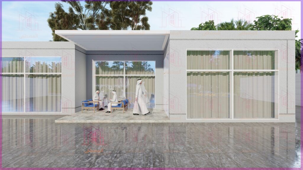
For villas and townhouses of up to three floors, Part K of the Dubai Building Code asks the design to follow the planning determinants, the development control regulations and the affection plan: setbacks, permitted entrances, reference level, service lines and other planning limits (section K.5.1). Where those documents differ from Part K, they take priority (section K.5.2.4). The table shows what to read from the site plan.
| On the site plan | What it decides in design | Code reference |
|---|---|---|
| Plot boundary, dimensions, area | The footprint available | B.2.1 |
| Setbacks | Where the annex or building may stand; the Code's table is used only if the determinants are unknown | K.5.1, K.5.2.4 |
| Floors and height | Number of floors; height measured from the road edge level at the plot's main entrance, with a 16 m maximum in Part K | K.5.2.2 |
| Parking | Required spaces; the site plan ratio prevails over the Code table | B.7.2.6.1 |
| Land use | What the building may be used for | B.2.1 |
For an annex, Part K allows annexes without a setback from the plot boundary if conditions are met, including at least 1.5 m from the main villa, an area of at most 60% of the main building's gross area and a height of at most 5.5 m (section K.5.2.3). Our Dubai Building Code guide explains these conditions. Buildings above three floors are outside Part K, so their floors and coverage come from the plot's own site plan and the engineer confirms the rest.
A simple order of work for plot owners
- Confirm the plot number, the owner's name on the title and which authority covers the plot.
- Obtain the current site plan, or ask your engineering office to. If an old copy is in the file, ask whether it needs renewing.
- Check ownership, permits and certificates for the plot in the digital portal.
- Write the setbacks, floors, height, parking and land use into the design brief.
- Give the full set to the licensed engineering office, which prepares the drawings; see our building permit guide for the next stage.
If a building already exists and was never licensed, the route differs: see how to license an existing annex.

Related services
Looking for a team to plan or build on your plot? Read about our annex design in Dubai and architectural engineering design services, and the contractor checklist. See also our services.
Frequently asked questions
What does affection plan mean in Dubai?
It is the official plot plan or site plan issued by the responsible authority. The Dubai Building Code says it shows the plot limits, dimensions, area, setbacks, surrounding areas and land uses.
Is the affection plan the same as the site plan?
Yes. The Code states that the affection plan is also called the site plan, and Dubai Municipality's service list calls the document the unified site plan.
How do I get an affection plan in Dubai?
Through Dubai Municipality's site plan service and the Kharetati app for plots under its planning, or through the Development Authority's portal for plots under its zoning. Your engineering office can usually request it with your consent.
What is a Makani number?
A number that identifies building entrances in Dubai's geographic address system and helps people and emergency services find the entrance. Dubai Municipality's mobile services list a request for a Makani number for a plot and for a Makani plate.
What is the difference between a site plan and a property map?
The Land Department's property map shows a registered property. The site plan shows planning data such as zoning, land use, floors and setbacks.
Can I see my plot's permits online?
Yes. Dubai Municipality's digital portal, which uses UAE Pass registration, shows site map issue details, building permits and completion certificates for the owner's plots.
What does the site plan control for a villa annex?
Setbacks, floors, height, parking and land use are read from it. Part K of the Code then adds annex conditions such as the 1.5 m gap from the main villa.
How much does a site plan cost?
Fees are set by the issuing authority and shown when you apply, so we do not quote figures.
Need help with your plot?
We are happy to look at your plot and idea and explain what the site plan means for the design. Message us on WhatsApp, use the contact page, try the free cost calculator or browse our projects.
This article summarises official Dubai Municipality and related documents and pages for owners. Services, steps and fees change, so the official sites and current documents prevail.
Official sources
- Dubai Municipality: About GIS and GIS projects
- GeoDubai: About the GIS Centre, Kharetati app and Makani app
- Dubai Municipality services list and service centres and Happiness Vehicle
- Dubai Municipality and Land Department: unified comprehensive land map project (January 2021)
- Government of Dubai Media Office: Dubai Municipality online portal for land and property data (August 2023)
- Dubai Land Department: property map request
- Dubai Development Authority: site plan issuance
- Dubai Building Code (2021 edition) and Decree 45 of 2021
- Local Order No. (2) of 1999 on classifying and codifying land uses in the Emirate of Dubai
Planning your next project?
Talk to the Al Mustafa team for advice and a quotation for your project in the UAE.
Related articles
 17 November 2026Periodic Inspection of a Villa Electrical Installation in Dubai: Alterations, Labels and Upkeep After HandoverRead article
 15 November 2026Building an Annex or Majlis with MBRHE Support: A Practical GuideRead article